UK Braces for Rare Freezing Chaos as Striking Orange Weather Maps Reveal Danger
UK weather maps have taken on a striking orange hue, heralding the arrival of a rare weather phenomenon that is poised to disrupt travel and daily life. The latest forecast charts released by WX Charts, which utilise Met Desk data, reveal that the United Kingdom is in for unusual freezing conditions that experts are warning are “extremely hazardous for aircraft”.
Meteorologists predict that a bout of freezing rain will sweep across the country on February 15, commencing at 6 am. Regions such as the Scottish Highlands are expected to bear the brunt of these hazardous conditions, with local reports from Birmingham Live highlighting the significant risks posed by the incoming weather event.
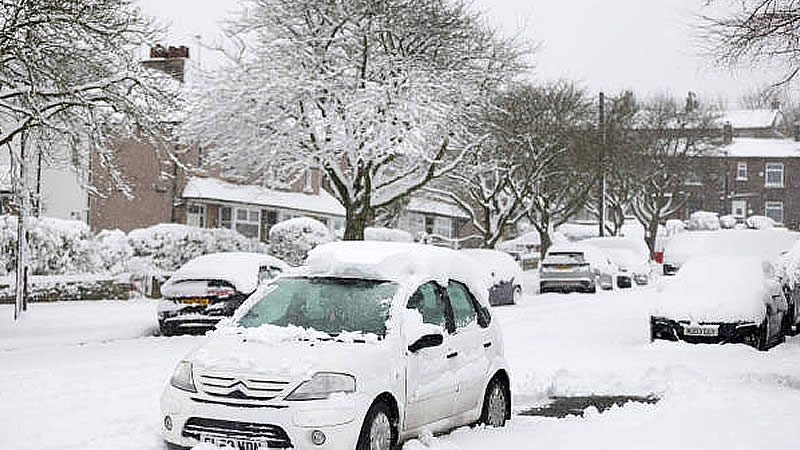
Freezing rain is an uncommon form of precipitation. When these rain droplets come into contact with surfaces that are already below freezing, they solidify instantly, coating everything in a shimmering layer of ice. This sudden transformation creates a dangerous environment, as the accumulation of ice can become heavy enough to snap power cables and bring down trees. In addition, the rapid freezing process complicates the work of gritters, leaving roads and runways perilously slick and raising severe concerns for aviation safety.
The phenomenon occurs when liquid droplets fall through a layer of colder air beneath the cloud level. In this situation, the droplets become “supercooled”—remaining liquid despite temperatures that are below the freezing point—and then freeze upon hitting any cold surface. The visual transformation can be striking, with trees, vehicles, and even street furniture taking on an almost surreal appearance under their icy coats. However, the beauty of these winter scenes belies the significant dangers they pose to both infrastructure and public safety.
The Met Office has provided insights into the broader weather pattern expected between February 8 and February 17. They explained: “High pressure will likely sit to the northeast of the UK during this period. Consequently, winds across many areas are likely to come from an easterly quadrant, with cold conditions likely, and there’s even the possibility of some snow at times.” This extended period of wintry weather may further complicate travel plans and everyday activities across the nation.
The coming weekend’s forecast offers a mix of conditions. As one detailed outlook stated, “Over the first weekend though, most places will be dry, if rather cloudy, with a few wintry showers possible near some southern and eastern coasts, but some sunshine elsewhere. During the following week, this theme continues, though the risk of wintry showers increases with a risk of some sleet or snow falling more widely for a time, still with some sunshine in between.” Meanwhile, temperatures are expected to dip significantly: “Temperatures will likely be a few degrees below average with some hard frosts and the wind may make it feel much colder at times.”
As communities prepare for this formidable weather event, local authorities and emergency services are on high alert, urging the public to exercise extreme caution, especially in high-risk areas. With both travel and aviation operations facing potential disruptions, the nation braces for a challenging period of icy weather ahead.