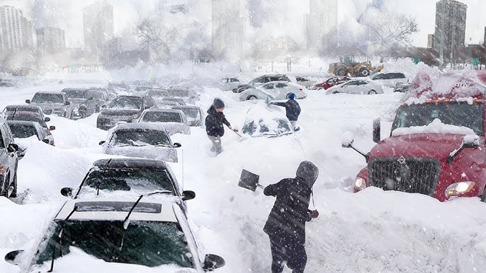
UK Braces for Snowpocalypse: 2-Inch-Per-Hour Whiteout on the Way
Just when you thought spring was finally settling in, weather models are now hinting at a bitter Arctic blast crashing in next month — and it could bring snow at a rate of up to two inches per hour across parts of the UK.
According to GFS weather modelling maps, a storm moving in from the Atlantic is set to sweep across England, Wales, and Northern Ireland in early April. The wintry spell is forecast to begin in the early hours of April 8, with snow hammering the south-west of England, southern Wales, and even reaching Belfast and parts of eastern Northern Ireland.
In some areas, the snowfall could be pretty intense. The data points to flurries falling at around 2cm per hour in parts of England early on — but by midday, things could ramp up significantly. London and southern-central England are expected to bear the brunt of it, with snow rates potentially hitting 5cm per hour. That’s roughly two inches falling every single hour, reported the Mirror.

And it’s not just snow causing misery. Elsewhere across the country, rain is set to pour down over the North West, Cumbria, Yorkshire, East Anglia, and the Midlands. Meanwhile, the western Highlands of Scotland could also see a dusting of the white stuff, just to round off the wintry mood.

By midday on April 8, maps show snow coverage building across southern Wales and the southwest, with 1 to 2cm likely to settle on the ground. There’s also potential for a light layer in the southeast, the Pennines, and parts of Scotland, although snow there is expected to be patchier.
The Met Office is keeping things cautious but has warned of a potential shift to “cooler weather” from April 1 to 10. Its latest outlook says: “Most places are expected to be dry with clear or sunny spells and light winds… It will probably remain slightly cooler near coastal areas… There is a chance for more unsettled and perhaps cooler weather for a time.”


Meanwhile, the BBC is sounding the alarm on a possible Arctic cold snap, warning that a high-pressure system could be pulling colder air down from the north or northeast — think Scandinavia-style chill. It’s a bit of a meteorological coin toss at the moment, with models struggling to lock down a consistent pattern. But one of the scenarios has the high pressure shifting over the north-west of Europe, allowing Arctic air to sneak in and bring not just snow, but potential overnight frosts.
Another possible setup would see more stable, dry weather under a settled high — but that too could shift towards Iceland or Greenland by the end of next week, opening the door again for that dreaded northerly flow. So, while April might usually mean spring flowers and longer days, don’t pack away your winter coat just yet. The weather gods might have one more icy surprise in store.
Don’t Miss These:
- Rosalía shares health update after food poisoning incident during Milan concert
- Bad Bunny seeks $465,612 in legal fees after winning ‘Enséñame a Bailar’ lawsuit
- Britain’s oldest supermodel Daphne Selfe dies aged 97
- Jon Stewart jokes about chaos as ‘The Bachelorette’ season gets pulled after scandal
- Ariana Grande reveals the mental health breakthrough that helped her return to the stage