UK Warning: ‘Polar Vortex Split’ Could Unleash 11 Inches of Snow
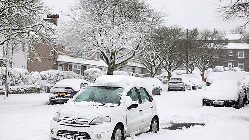
A dramatic change in weather is expected as a “polar vortex split” could soon unleash up to 11 inches of snow across parts of the UK, reported by Galway Beo. After a brief reprieve of sunny weather following the havoc caused by storms Eowyn and Herminia, the cold is set to return as Arctic air rapidly descends, creating the potential for significant wintry disruption.
Forecasters have issued stark warnings that the break in mild conditions may be short-lived. Experts from Severe Weather EU shared detailed maps on social media platform X, highlighting the possibility of a pronounced split in the polar vortex.
They wrote: “Are you ready? The potential for a significant deformation of the polar vortex and its split through mid-February is increasing.” Advanced weather models, including those from WXCharts, also indicate that a snow front may be advancing from the continent towards the UK, with ECMWF projections showing heavy snowfall beginning around February 13.
Snow depth maps for February 14 suggest that up to 27cm (11 inches) could settle in Scotland, while northern parts of England might see around 10cm (four inches) of snow, with only southern and central England likely to escape the worst of the blizzard.
The science behind this phenomenon is rooted in the dynamics of the polar vortex. According to the Met Office: “Every year in winter, strong westerly winds circle around the pole high up in the stratosphere. This is called the stratospheric polar vortex and it circulates around cold air high over the Arctic.
In some years, the winds in the polar vortex temporarily weaken, or even reverse to flow from east to west. The cold air then descends very rapidly in the polar vortex and this causes the temperature in the stratosphere to rise very rapidly, as much as 50C over only a few days; hence the term sudden stratospheric warming.
As the cold air from high up in the stratosphere disperses it can affect the shape of the jet stream as the cold air sinks from the stratosphere into the troposphere. It is this change in the jet stream that causes our weather to change.” This explanation underscores how shifts in high-altitude air currents can dramatically alter weather patterns on the ground, leading to sudden, severe weather events.
Looking ahead, the Met Office forecast for February 7 to February 16 notes: “High pressure will sit close to (and probably to the east of) the UK in this period. Consequently, southern and eastern areas are likely to see the driest conditions, with lightest winds, which could lead to overnight frost and fog with temperatures a little below normal.
Further north and west, there is a risk of incursions of Atlantic air and frontal systems at times, which would bring some rain here, but with milder temperatures.” However, they caution, “There is a very low chance that if the high orientates in such a way that a more easterly (rather than southerly/southeasterly) flow develops, a spell of much colder conditions could develop across the UK, with a risk of wintry showers in some parts.”
Residents and commuters are advised to remain alert as forecasters continue to monitor the situation, with preparations underway for potentially record-breaking snowfall in the coming days.