“Massive Area of Rain Set to Batter Britain” Summer Weather Comes to a Sudden End
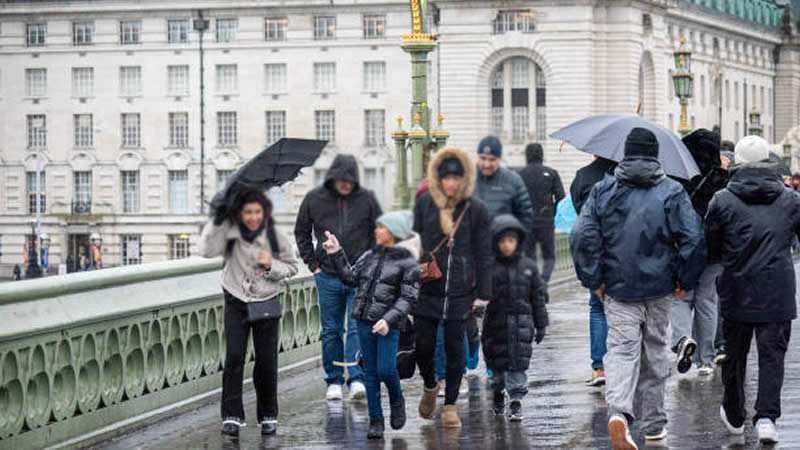
A massive area of rain, stretching nearly 1,000 miles, is poised to batter Britain in the coming days, bringing an abrupt end to the glorious summer conditions. Weather maps indicate that the extensive band of rain will hit around mid-August, potentially ruining many people’s summer plans.
The deluge is expected to hit hardest in the North of England and the Midlands, with the heaviest rainfall anticipated on Monday, August 12. The forecast predicts as much as 35mm of rain on that date, giving people less than a week to enjoy the remaining hot weather.
The Met Office, in its forecast for August 9 through August 18, noted: “The weather across the UK is expected to remain variable. Complex developments in the Atlantic lead to increased uncertainty in the forecast detail, however, the general flavor is for the weather to remain unsettled.”
The forecast also mentioned that developing low-pressure systems are likely to bring showers or longer spells of rain at times, particularly heavy across western hills. Breezy or strong winds are possible, especially along coastal areas. The greatest chance of any settled weather is more likely in the south and east, although there may still be periods of wet, thundery, or unsettled weather.
“There is a reasonable possibility of temperatures in the south exceeding the seasonal average, potentially accompanied by brief hot spells. Meanwhile, temperatures in the north are likely to remain closer to the long-term average,” the Met Office added.
As of last night, two flood alerts were in place in the UK. The first is for the Rivers Ehen, Calder, Irt, and Esk, and the second for the Upper River Derwent, Stonethwaite Beck, and Derwent Water.
Today’s forecast indicates that rain will continue to move eastward, weakening as it progresses and clearing by late afternoon. “Fresher but brighter conditions” are expected to follow, accompanied by scattered showers. The Met Office stated: “Cloudy start to Tuesday in the east as outbreaks of rain gradually clear. Brighter elsewhere with some sunny spells, though scattered showers arriving into the northwest later in the morning.”
Last night, millions of people across the country enjoyed a more comfortable night as fresher air arrived behind a cold front. The Met Office confirmed that all areas will experience cooler temperatures tonight.
However, the organization noted “very low confidence” in the weather forecast for the latter part of the month. They indicated that there could be prolonged spells of rain mixed with dry spells, adding to the uncertainty of summer plans.
As Britain braces for the incoming weather shift, residents are urged to stay updated with the latest forecasts and prepare for the potential disruptions the massive area of rain might cause.